
Services and programmes
Field services that turn flights into evidence
Customer-facing work built on the five divisions, presented by maturity rather than ambition.
Training is delivered in the field. SiteWatch is a defined service offering and BhumiChitra is pilot-informed. Drone-Krishok, Aeromint and High Lift Class I are in development, and none of them is described here as a validated product.
How to read this page
Every workstream below carries a maturity label, and the label means what it says. Service offering is something we deliver now. Pilot-informed means the workflow has been shaped by a real pilot but is not yet a launched service. Current prototype and Development concept are exactly that, and Design-stage MVP is an aircraft that exists as a design and a test plan, not as a product.
Claims advance only when evidence advances. Each workstream states what it is, what it is not, and what has to be shown before it moves up a step.
Bengal SiteWatch
Service offering · Visual mapping and monitoring
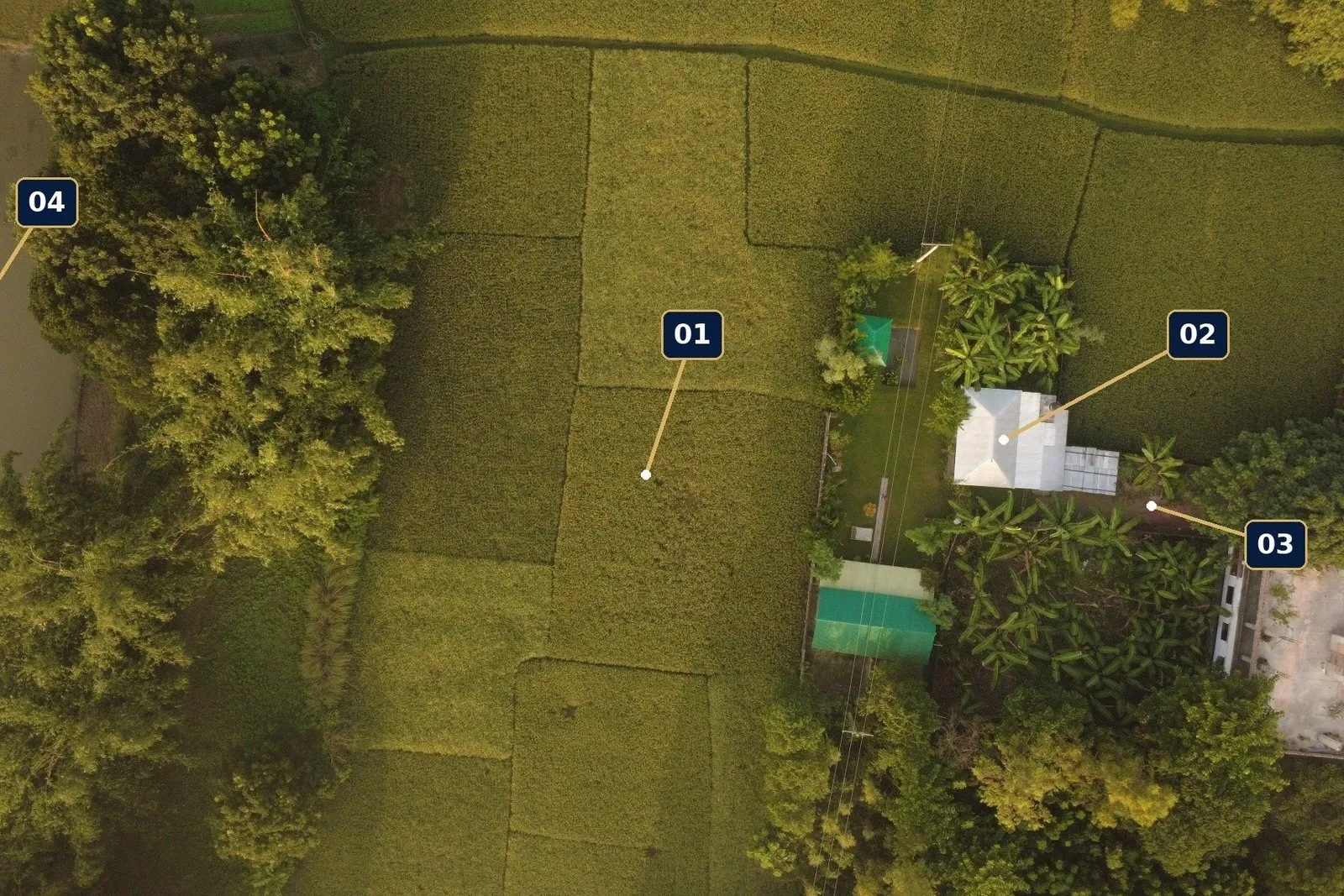
Drone mapping and repeat visual reports for overseas owners, business owners and landowners who cannot be on site and cannot see what is changing on land they own.
- Online assessment — free. A remote suitability check, followed by a written quotation.
- Physical report. Two visits about 15 days apart: a baseline, then a progress report.
- SiteWatch Ongoing. Two visits a month, a monthly summary and an open-issues tracker, quoted monthly.
SiteWatch is a visual inspection only. It does not certify legal boundaries, structural safety or work quality. The final price depends on site size, travel and scope, and is confirmed by written quotation.
BhumiChitra
Pilot-informed · Drone mapping for land
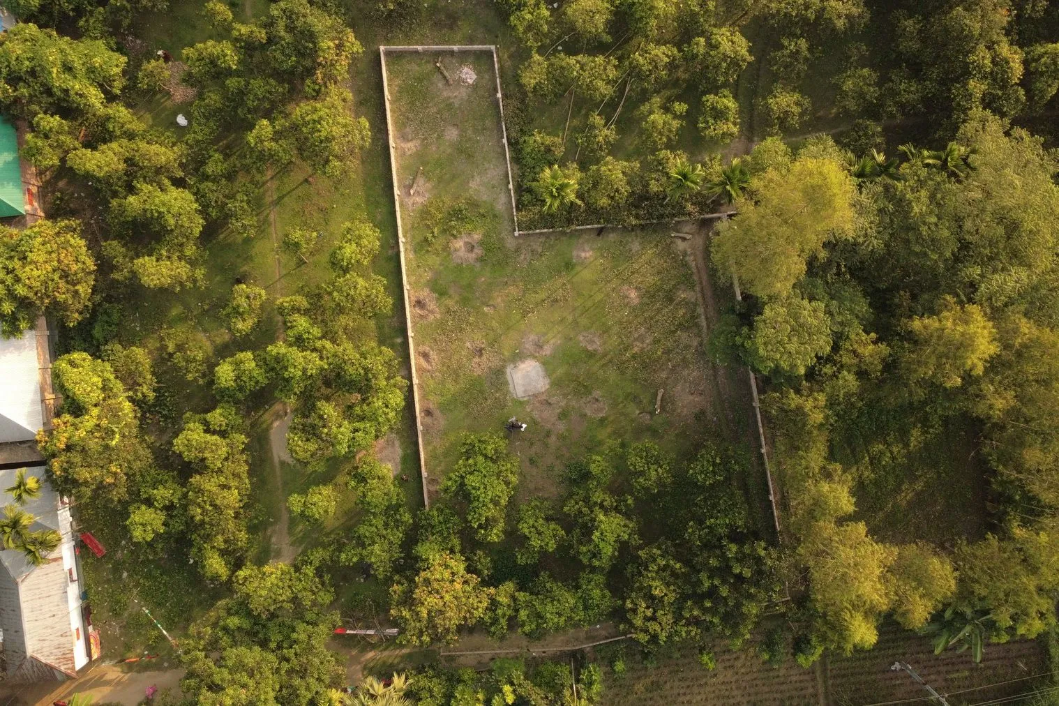
Clear aerial evidence for land discussion, site planning and professional review — with paper records and current site evidence kept separate, so neither is mistaken for the other.
- Site Record — up to 10 decimal, delivered in 5 working days.
- Compare — up to 30 decimal, with a comparison against the records, in 7 days.
- Controlled Mapping — up to 2 acres, with orthomosaic, elevation and GIS outputs, in 10 days.
The workflow was shaped by a pilot with land office employees, using real sample material. These are proposed launch packages, and each is quoted in writing after an assessment.
BhumiChitra is decision support only. It does not establish ownership or replace a licensed cadastral survey, and the pilot implies no government affiliation or endorsement.
Drone-Krishok
Current prototype · Farmer decision app
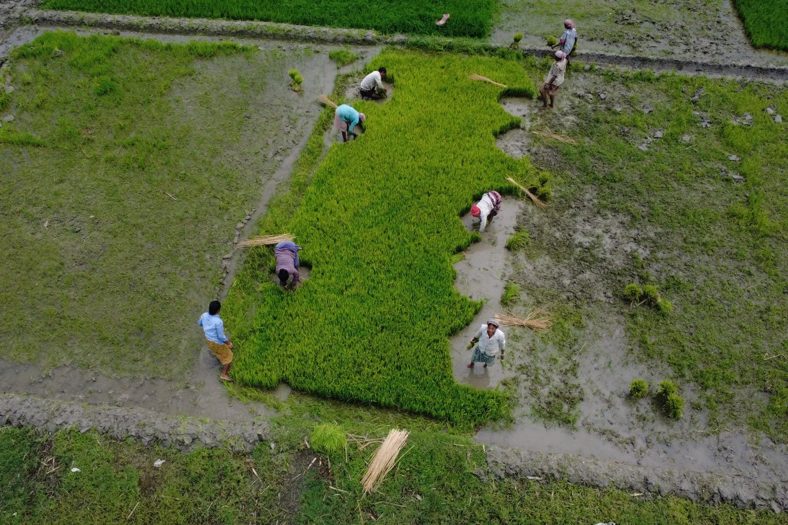
Farmers often decide when and where to sell without seeing prices across districts. Drone-Krishok puts market prices, field decisions and drone services in one app, following one loop: price → plan → service → follow-up.
The prototype includes district market prices, an AI crop-disease photo check, a personal crop calendar, weather and soil alerts, loan and subsidy help, drone service booking (spray, spread, inspect) and a digital plot record.
The model to test is simple: free daily price checks build the habit, and paid advice and drone field services carry the revenue. The first pilot is planned to run for 90 days in one upazila, on one priority crop, with 50–100 farmers across 2–3 nearby villages.
Those are pilot targets, not forecasts. Market-data partnerships, update frequency, repeat use, service delivery and willingness to pay all need pilot validation before anything more is claimed.
Aeromint
Development concept · Drone marketplace and engineering hub
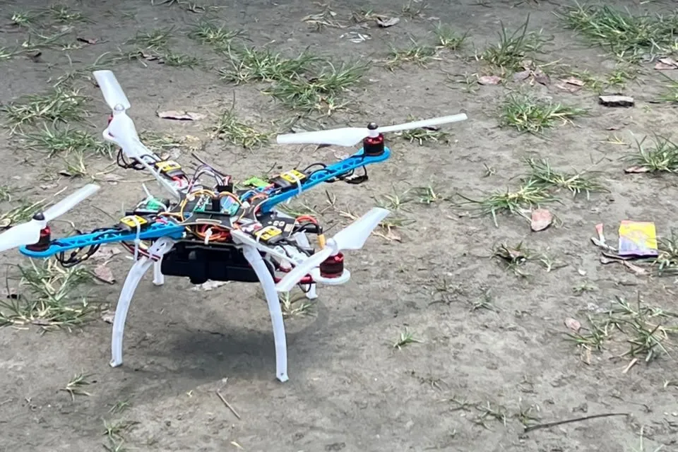
Bengal Aerospace’s own build, used at field training events.
Drone buyers and builders often struggle to match compatible parts to a mission. Aeromint is planned as a place to discover aircraft, source compatible components and build with structured guidance — from the first question to the first safe test flight.
- Explore — find drones and parts by mission.
- Build — configuration-specific assembly and checks.
- Learn — kits, workshops and guided projects.
AI explains, rules check compatibility, and engineers review safety-critical decisions. Every answer carries a label: Verified, Compatible or Experimental. The first learning path draws on Bengal Aerospace’s own S500 build.
Configuration, availability, warranty routes and supplier relationships still need verification, and no reseller authorisation is implied.
Bengal High Lift Class I
Design-stage MVP · Electric cargo UAV, developed by Plavata Systems
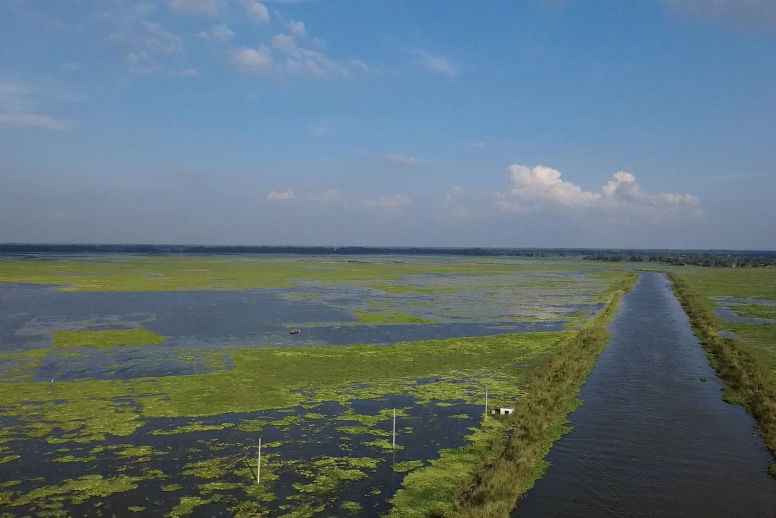
The terrain it is designed for. The aircraft itself is at design stage and is not pictured.
Floods, cyclones and rivers can turn a small urgent delivery into a slow mission. High Lift Class I is a locally serviceable six-rotor electric cargo UAV for critical logistics in flooded, riverine or congested areas: move a compact payload quickly, record what happened, and repair it close to where it flies.
The Rev A design targets are a 5 kg rated payload, 12 minutes of loaded endurance, a maximum take-off mass of about 12 kg, and six rotors in an electric VTOL layout. The baseline architecture calls for at least 24 kgf of aggregate thrust, a 12S (44.4 V nominal) battery, a Cube/Pixhawk-class flight controller, 360° and downward ranging, and a rigid, modular, CG-adjustable payload bay.
These are design targets, not validated performance. No certification, approval or production readiness is claimed.
The first missions it is being designed for:
- Medical — medicines, blood products and diagnostic samples between facilities.
- Disaster relief — compact emergency supplies and communications kits.
- Infrastructure — sensors and spares for energy, water and telecom.
- Environment — sensor deployment in hard-to-reach areas.
The development path runs from design baseline through bench tests, integration and flight, to field missions and a frozen Rev B specification. A commercial price is set only after that freeze.
Work with us
We welcome partners in training, field services, applied research and evidence-led pilot programmes. Back the workstream that fits your mandate, or talk to us about the company as a whole.
- Support the High Lift Class I MVP — a milestone-gated programme from design baseline to Rev B specification.
- Back the Drone-Krishok pilot — pilot funding, market-data partners, an agronomy and service network, and buyer and market access.
- Sponsor rural drone and STEM training — district workshops, girls’ STEM cohorts, rural drone clubs, a mobile training lab, or outcome research, through the Bengal Aviation Initiative.
- Use or refer our field services — SiteWatch and BhumiChitra start with a free online assessment and a written quotation.
- Co-develop applied research pilots — evidence-led pilots in river intelligence, disaster response, rural enterprise or critical delivery in difficult terrain.
For company-level investment, write to info@bengalaerospace.com. Amount, structure and use of funds are discussed directly with interested investors.
All flights depend on consent, weather, safe operating conditions and airspace requirements. Third-party names are cited for context only.
Contact
Get in touch
Send a message and it reaches the Bengal Aerospace team directly.
- info@bengalaerospace.com
- Phone
- +880 1678 536790
- Registered address
- 998, Road 9, Mirpur DOHS
Mirpur, Dhaka
Bangladesh
Message sent
Thank you — your message has reached Bengal Aerospace. We will reply to the address you gave.